Menu
Menu
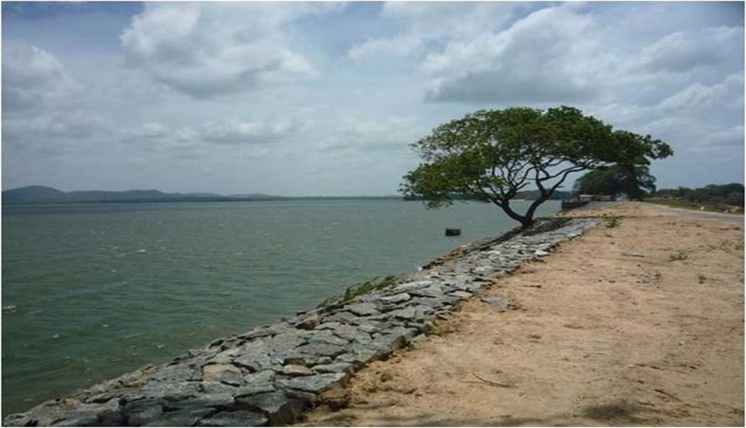
Minneriya Reservoir
Profile; ?>Minneriya tank is sited in a flat area of agricultural plain and has a catchment area of 23,983 ha. It receives water from Polgolla via Bowathenna, Moragahakanda, and Elahera-Minneriya Yoda Ela (EMYE) in addition to the local inflows. Minneriya dam is a homogeneous /earth-fill embankment with a length of approximately 2,320 m and a maximum height of 20m and comprises two embankments separated by a hill.
Minneriya reservoir is situated between LAT 7058’44” and LON 80050’00”. Annual rainfall is 1500 – 2000 mm and the average temperature is around 300 Celsius in Minneriya area. The North-East monsoon is activated from October to January but the rest of the year this area is suffering from the dry situation.
The immediate catchment of the Minneriya reservoir is a habitat area for large herds of elephants and many other wild animals. This area was designated as a national park on 12 August 1997, having been originally declared as a wildlife sanctuary in 1938.
Minneriya reservoir issues water for paddy fields in Minneriya irrigation scheme as well as provide water to National Water Supply and Drainage Board to serve as potable water. Also, this reservoir being utilized for inland fisheries and tourism industries.
History
Minneriya reservoir is believed to build by King Mahasen (275-301 AD). He improved the Elahera barrage built by King Wasaba to feed water to Minneriya reservoir through Elahera-Minneriya-Yoda-Ela trans basin canal. Minneriya reservoir has been identified by several names like “Minihiri”, “Manihira”, “Minihiriya” and “Minihoru” in history.
Water Heritage
The structure was an example of engineering marvel or excellence at the time of its construction;
Minneriya reservoir belongs to Polonnaruwa Irrigation Region and it is located in Minneriya Divisional Secretariat Division in Polonnaruwa District in North Central Province.
The maximum capacity of the Minneriya reservoir is 135 MCM. It serves 9,099 hectares of paddy land and its catchment area is 23,983 hectares. The main spillway called Agalawan oya, discharges along 6 km long canal into the Kaudulla reservoir. It compromises a gated section with 7 nos of radial gates together with ungated ogee section. There are two spills called Agalawan oya spill and Minneriya-Kantale Yoda Ela (MKYE) spill. The other spillway called MKYE directs water to Kantale reservoir. The MKYE spill tail canal act as the Kantale feeder canal.
The Technical details of the reservoir can be found as follows:
Table 1: Technical details of the reservoir
|
NO |
DATA |
Unit |
Reservoir Name |
|
|
|
|
Minneriya Reservoir |
|
|
GEO DATA |
|
|
|
|
Province |
|
North Central |
|
|
District |
|
Polonnaruwa |
|
|
Nearest City |
|
Polonnaruwa |
|
|
Major Basin |
|
Mahaweli |
|
|
Purpose |
|
Irrigation |
|
1 |
HYDRO DATA |
|
|
|
1.1 |
Co-ordinates |
|
8.0471080 E 80.9003250N |
|
1.2 |
Catchment Area |
ha |
23,983.00 |
|
1.3 |
Capacity @ F.S.L |
MCM |
135.78 |
|
1.4 |
Full Supply level |
m MSL |
93.72 |
|
1.5 |
High Flood Level |
m MSL |
95.32 |
|
1.6 |
Area @ F.S.L |
ha |
2550.61 |
|
1.7 |
Head of Water |
m |
11.61 |
|
1.8 |
Specified Acreage |
ha |
9099.19 |
|
1.9 |
Minimum operation level |
M MSL |
82.09 |
|
2 |
Dam |
|
|
|
2.1 |
Type of embankment |
|
Earthen |
|
2.2 |
Length of embankment |
m |
2320 |
|
2.3 |
Dam top Level |
m MSL |
97.15 |
|
2.4 |
Free Board |
m |
1.83 |
|
2.5 |
Top Width |
m |
7.62 |
|
2.6 |
Maximum Embankment Height |
m |
20.43 |
|
2.7 |
Side slope U/S |
|
1 on 3 |
|
2.8 |
Side Slope D/S |
|
1 on 2.5 |
|
3 |
Spill |
|
|
|
3.1 |
Agalawan oya spill |
|
|
|
3.1.1 |
Type of Spill |
|
Radial Gates & CO spill |
|
3.1.2 |
Crest Level |
m MSL |
93.72 |
|
3.1.3 |
Type of gate |
|
Radial |
|
3.1.4 |
size of gate |
m |
6.09 x 3.65 |
|
3.1.5 |
No of gates |
|
7 |
|
3.1.6 |
Length of spill |
m |
42.68 |
|
3.1.7 |
CO spill length |
m |
18.29 |
|
3.2 |
MKYE spill |
|
|
|
3.2.1 |
Type of spill |
|
Radial Gates |
|
3.2.1.1 |
Crest level |
m MSL |
93.90 |
|
3.2.1.2 |
Type of gate |
|
Radial |
|
3.2.1.3 |
Size of gate |
m |
4.57 x 2.43 |
|
3.2.1.4 |
No of gates |
|
2 |
|
3.2.1.5 |
Length of spill |
m |
9.14 |
|
3.2.2 |
Type of spill |
|
Silt removing gates |
|
3.2.2.1 |
Crest level |
m |
91.44 |
|
3.2.2.2 |
Type of gate |
|
Vertical steel gates |
|
3.2.2.3 |
Size of gate |
m |
1.52 x 1.21 |
|
3.2.2.4 |
No of gates |
|
2 |
|
3.2.2.5 |
Length of spill |
m |
3.04 |
|
4 |
Sluice (L/B) |
|
|
|
4.1 |
Sill Level |
m MSL |
83.82 |
|
4.2 |
Type |
|
RCC tower |
|
4.3 |
No of Opening |
|
3 |
|
4.4 |
Size of Opening |
m |
1.21 x 0.85 |
|
4.5 |
Location from L/B end |
m |
1300 |
|
4.6 |
Maximum Discharge |
cumec |
24.2 |
|
5 |
Sluice (R/B) |
|
|
|
5.1 |
Sill Level |
m MSL |
51.81 |
|
5.2 |
Type |
|
RCC tower |
|
5.3 |
No of Opening |
|
1 |
|
5.4 |
Size of opening |
m |
0.91 x 0.79 |
|
5.5 |
Location from L/B end |
m |
2100 |
|
5.6 |
Maximum Discharge |
cumec |
3.5 |
|
6 |
Inlet Channel |
|
|
|
6.1 |
Source |
|
Water diverted from EMYE |
|
6.2 |
Length of canal |
km |
46.67 |
|
6.3 |
Head Anicut |
m |
Elahera Radial Gate |
|
7 |
Canal data |
|
|
|
7.1 |
Length of main canal |
|
- |
|
7.2 |
LB |
km |
23.22 |
|
7.3 |
RB |
km |
10.75 |
|
7.5 |
Total length of Distributary canal |
km |
123.59 |
|
7.6 |
Total length of field canal |
km |
201.80 |
Present State of Conservation
Minneriya dam was rehabilitated under the Dam Safety and Water Resources Planning Project (DSWRPP) funded by World Bank during 2010-2015. Identified Major rehabilitations by DSWRPP are; renovation of rip rap, strengthening of the dam, the establishment of bathing steps, establishment of toe filter & toe drain, installation of piezometers on d/s slope of the dam, construction of access road for inspection, installation of levelling monuments and installation of boundary stones.
Minneriya being an old dam with unknown quality of construction poses a threat to management in taking risks during flood management. Besides, sudden release of water from the reservoir through spill gates also create a disastrous situation for the downstream residents. Therefore, an Emergency Action Plan (EAP) was prepared to define responsibilities and provides specific procedures designed to identify unusual conditions that may endanger the Minneriya dam. It further elaborated mitigative action to be taken in the event of distress or potential failure of the dam as well as emergency relating to the sudden high-water release from the reservoir. This document also provides procedures and information to assist Irrigation department to notify appropriate emergency management officials in issuing an early warning and notification messages to people living in critical areas downstream of the reservoir in case of an emergency. The procedures outlined in this EAP are used to protect the public from property damage or loss of life as a result of uncontrolled release of water due to dam breach.
HIGHLIGHTS
Country: Sri Lanka
Province: Polonnaruwa
Latitude : 213,727 E Longitude : 315,041 N
Built: 275 - 301AD
Basin: Mahaweli River basin / Amban Ganga Basin
Irrigated Area: 9099 Ha
70th IEC Meeting, Bali, Indonesia, 2019