
 Menu
Menu
Liao River Irrigation District
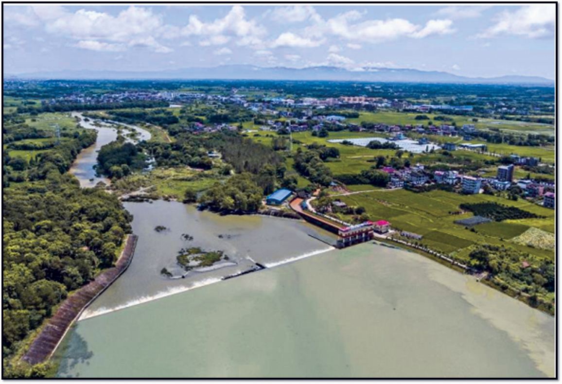
Profile; ?>Liao River Irrigation District is located in Fengxin County, the northwest of Jiangxi Province. It belongs to the Liao River Basin, a tributary of the Xiu River. Liao River is the largest tributary on the south bank of the lower reaches of Xiu River Liao River Irrigation District has been developed based on three weir water conservancy systems, namely, Pu Weir, Wushitan Weir and Xiang Weir. It is a large-scale irrigation district with the functions of flood control, drainage and soil and water conservation. It is also the earliest multi-dam gravity diversion irrigation district built in Jiangxi Province, with an irrigation area of 22,400 ha.
With a long history, the irrigation district originated in the Tang Dynasty. According to the literature available, the Pu Weir project, located on the North Liao River beside Chexiachen Village, Xiangtian Township, Jing’an County, is a weir built of firewood and soil by local villagers in the Taihe Period (AD 827-835) of the Tang Dynasty. It is the earliest irrigation water conservancy project in the irrigation district. In the 12th year of the Chenghua Period in the Ming Dynasty (1476), people of Congshan Township in Fengxin County built Wushitan Weir on the bank of Wushi Lijia Village, about 3 km upstream from the Pu Weir. They led the villagers to chisel the stone mountain spur, dredge the river, and divert the water in the pond to Yanghao Weir, about two li (1 li = 0.5 km) away, where they built the south and north ditches to channel water to irrigate the farmland of Fengxin and Jing’an counties; in addition, the local people in the Ming Dynasty built Xiang Weir on the bank of Macao Lake, Xiangjia Subdistrict, about 1 km upstream from Wushitan Weir.
After multiple times of renovations and reinforcement, the water conservancy projects of the three weirs have reached their current scale, capable of irrigating 3593 ha, 1040 ha and 1753 ha of farmland, respectively. Liao River Irrigation District was gradually developed and expanded based on the above three water conservancy systems. There are 7 trunk canals in Liao River Irrigation District, with a total length of 152.0 km, 213 branch canals, with a total length of 540.1 km, and 853 structures in the main canal system. The multiple-cropping index of crops is 2.12 with the main crops in the irrigation district being rice, cotton and rape.
The project site selection is scientific and reasonable. They are all water diversion projects using weirs, typical in the southern hilly areas. Their planning and design are scientific, as the local water flow environment and actual conditions of irrigation of farmland were taken into full consideration. The weirs were built at the river bends, with slow water flow, to reduce the impact on the weirs, thus ensuring the effective and consistent operation of the facilities. In addition, the weirs are located at the hard riverbed in the upper and middle reaches of the river, with a stable dam foundation and less sand sediment on the dam, so desilting is scarcely needed, and less damage will be caused to the dam foundation, to extend the service life.
The ancient weirs in the irrigation district are steeped in rich water conservancy culture, having a profound influence on the local communities. Having been in continuous operation for over one thousand years, the irrigation district has promoted the local economic development, maintained social security and stability, and played an important role in flood prevention, irrigation, navigation, reasonable utilization of resources, as well as an indispensable role in handling regional flood, drought, deterioration of water environment and other problems, contributing significantly to safeguarding the security of grain output, water use, ecological environment and sustainable development of agriculture in the area.
HIGHLIGHTS
Country: China
Province: Jiangxi Province
Latitude : N28 Longitude : E 115
Built: AD 827 - 835
River: Liao River (tributary of Xiu River)
Irrigated Area: 22,400 ha
72nd IEC Meeting, Marrakesh, Morocco, 2021
.jpg)
.jpg)
.jpg)
