Menu
Menu
Waterwheels of Heet
Profile; ?>The Akkadians settled on the western bank of the Euphrates River between the region of Aneh and Heet in the fourth millennium BC, where they cracked the streams from the Euphrates to the agricultural lands and practised agriculture based on free-flow irrigation. For hydrological reasons, the bottom of the Euphrates River fell, and the irrigation water receded from its courses, which led to the degradation of agriculture. The farmers faced this problem with the idea of inventing wheels that rotate with the force and speed of the water flow in the river, and they called it Na’oor (singular form for a waterwheel) and Nawa’eer (plural form for waterwheels).
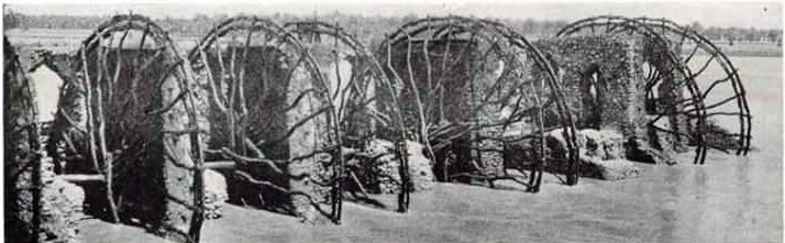
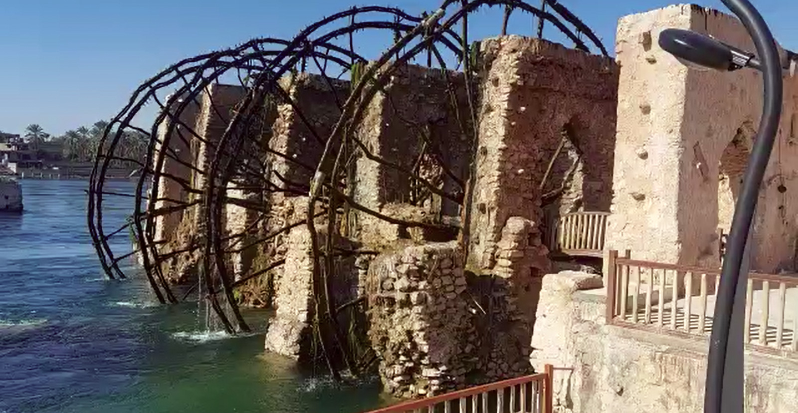
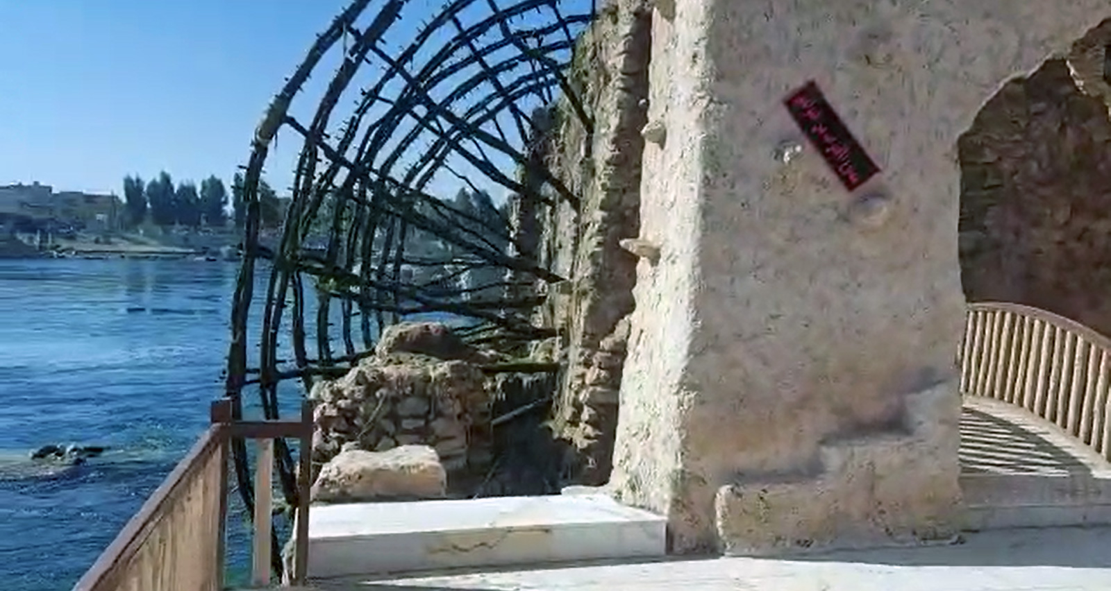
The Waterwheels were constructed over the Euphrates River in Heet City more than 2500 years ago and occupy an area of 2500 m². A waterwheel is a wooden wheel 11.6 m in diameter installed on a structure (constructed from stone and limestone) in the middle of the river called Aldaliya which carries 4 waterwheels. The waterwheel is made of only wood and ropes and no other materials are used. The main goal of their construction is to irrigate agricultural lands and grind grains by connecting the mills to the waterwheels. Waterwheels used to irrigate the agricultural lands of several farmers in the Turbeh Village until the '80s of the last century in a shape of a river strip with dimensions of (1500*150) m² i.e., 90 donum.
A waterwheel consists of the following parts:
- Al ober: Wooden axis around which the waterwheel rotates.
- Al sulban: It is everything in the form of two intersecting lines that connect Al ober to the waterwheel perimeter.
- AlKefaf: Wooden sticks of which the waterwheel perimeter is made and on which Alqawaqa is fixed.
- Alqawaqa: Pottery jars that ladle the water from the river and pour into the water stream.
- AlHufuf: Wooden nails used for binding waterwheels parts together.
- Alsubn: Wide nails, the length of each is two feet, placed between Al'ober and Alsulban.
- Alsadan: Wooden parts on which Al'ober is put.
- Al-karaked: A wooden piece used to complete the cross if it is short.
- Albethora: A wooden square connected to the waterwheel tip to increase its rotational speed.
- Alrabtta: A strong rope to which the waterwheel is tied to stop it for maintenance purposes and not to be swept away by water current during flood season.
The waterwheels certainly existed for more than 2000 years ago, when a mosaic panel was discovered in the city of Anemia dating back to the year 469 BC, confirming the existence of the waterwheels before this period, as the human populations that inhabited these areas, especially between the city of Rawah and Heet, depended entirely on agriculture, which in turn needs the waterwheels to raise water from the river to the agricultural lands, in addition to using them to operate grain mills by connecting them to the wheels to become water mills. These activities require a close link between the groups of the community to manage it, especially the management and evaluation of the irrigation water, which is managed by the beneficiaries and not by the ruling authority, where farmers have become organized in the form of a family or village gatherings to build waterwheels on the river which are managed in a participatory system and within agreed-upon laws. These activities have contributed to the development of the economic situation and the increase in incomes for the beneficiaries by transferring the local surplus of agricultural crops and handicraft industries to other cities via the river and by means of wooden rafts (Aklak) that resemble ships as they descend with the current of the river to the cities of the south to transport these goods. The management of this system was carried out in the past by farmers. However, due to industrial development, these waterwheels were replaced by mechanical pumps and mills.
HIGHLIGHTS
Country: Iraq
Province: Al-Anbar Governorate
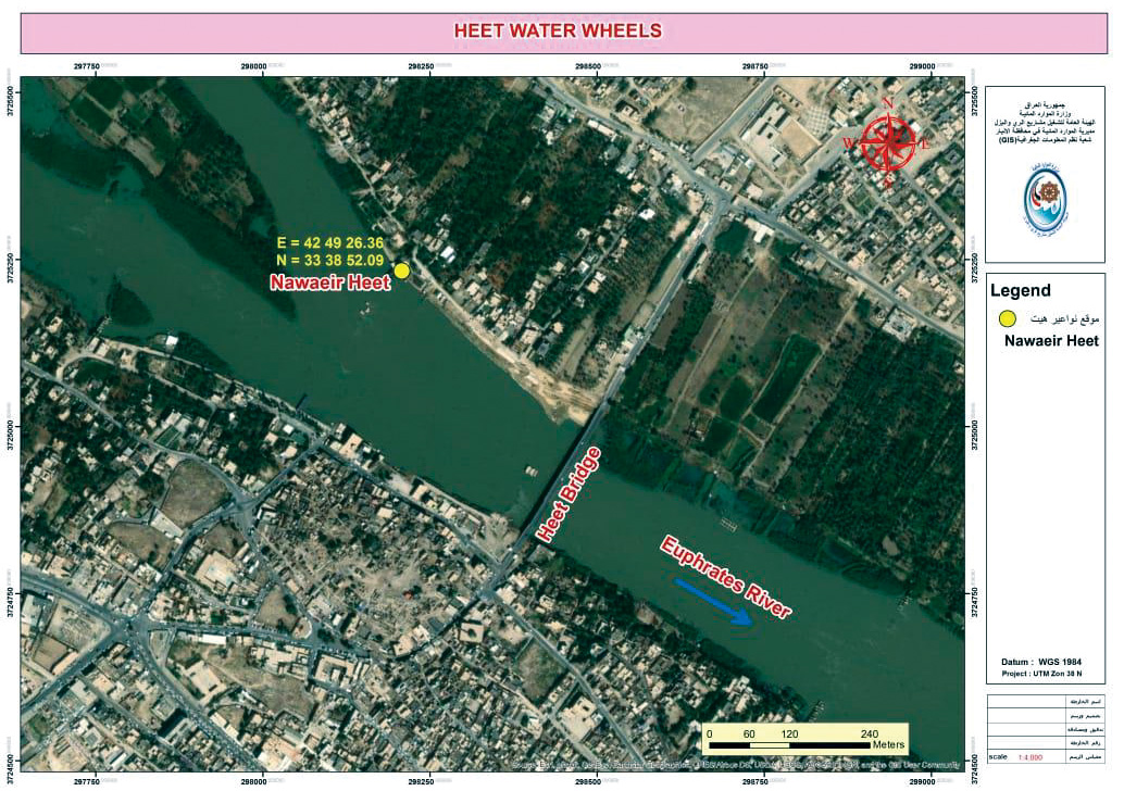
Latitude : N 33 ° 38 ′ 52 ''. 09 Longitude : E 42 ° 49 ′ 26 ''. 36
Built: More than 2500 years ago
River: Euphrates River
Irrigated Area: 90 dunum
72nd IEC Meeting, Marrakesh, Morocco, 2021