Menu
Menu
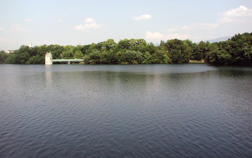
Teragaike Pond and Teragaike Waterway
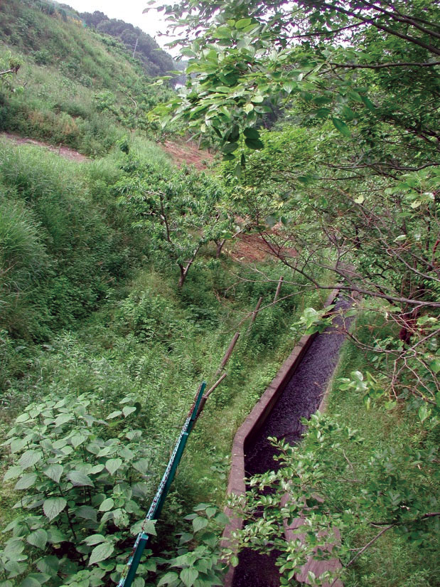
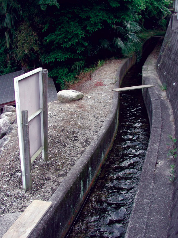
Profile; ?>Teragaike Pond, located on the Akamine Plateau, is the largest reservoir in Kawachinagano City, Osaka Prefecture. Teragaike waterways run from the Ishikawa River, the water source, to beneficiary areas via Teragaike Pond. Teragaike waterway is a general term for the waterways that are being drawn upon. Among the waterways, the section from the Ishikawa River to Teragaike Pond is referred to as Teragaike Waterway.
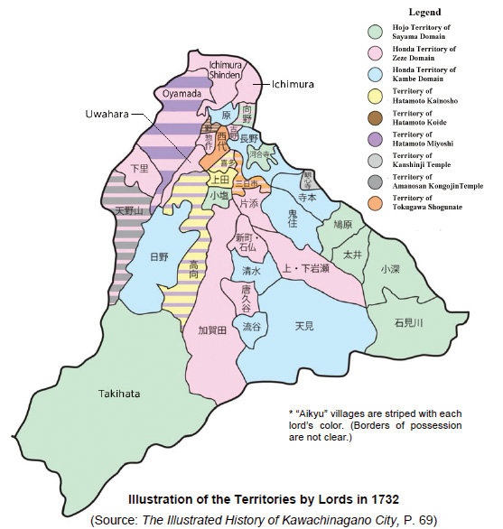
Construction of Teragaike Pond and Teragaike Waterway took 16 years, from 1633 to 1649, under a municipal plan to develop new rice fields in Ichimura Village. The original intention was to redirect water to newly reclaimed fields, by expanding a small pond into a much larger one by utilizing the natural terrain. The water source for the pond is the Ishikawa River, which is located 6 km to the south.
It has been stated that a total of 40,000 people worked continuously on the project. The slope of the 8.2-km-long waterway was measured at night under the light of lanterns, while during the day the waterway was dug. The full watered area of the pond is approximately 13 ha with 2197 m perimeter and water storage capacity of approximately 600,000 metric tonnes. The embankment height and length on the north side of the pond are 15 m and 126 m respectively. Upon completion, crop production increased 100-fold. Thus, Teragaike Pond and Teragaike Waterway are public works facilities symbolizing an important historical stage of transformation in the development of irrigated agriculture in Japan.
The three most popular ponds in southern Osaka Prefecture are said to be Teragaike, Sayama and Izumi Kumeda Ponds (in that order). Teragaike Pond is also widely known for its depth. Although the number of beneficiary areas has decreased due to residential development, it still plays an important role in supplying agricultural water to local fields. Furthermore, the zone around Teragaike Pond has been developed as a municipal park and citizens enjoy it as a place to relax in and as an interactive space.
The construction of the Teragaike Pond is an extension of the original small pond. The east and west sides of the pond utilized the hills on both sides as banks. The north and south banks, which are shorter in length, were constructed using soil to form a larger pond. Some village neighbourhoods were submerged due to the pond’s expansion, which shows that developing the new rice fields was very much a priority at the time.
From its construction till present, many renovations have been carried out on Teragaike Pond to maintain its function, mainly around its sluice gates and embankments. As the original metal parts used in the sluice gates were iron and tended to rust quickly, copper ones replaced them in 1744. In August 1854, due to a severe earthquake, about 34 m of the embankment was damaged. About 945 workers took part in the repair work. A sticky soil, known as hagane, was used to reinforce the embankment and resist the high water pressure.
A structure called a "throwing hole" was adopted for the intake of water to the reservoir, which enables a large pond like Teragaike Pond to take in water according to the height of the water surface. This system is said to have been first adopted in the nearby Sayama Pond in around 1600, and the present-day Teragaike Pond has the same structure.
With recent urbanization, the beneficiary areas of Teragaike Pond and Teragaike Waterway have been decreasing but the current state of the pond is being maintained, with renovations carried out by managers and beneficiaries for generations, and the pond is still providing a stable supply of irrigation water for agricultural lands. The current beneficiary area is estimated to be approximately 25 ha.
HIGHLIGHTS
Country: Japan
Province: Osaka Prefecture
Latitude : N34.46541208 Longitude : E135.5595973
Built: 1649
River: Ishikawa River
Basin: Yamatogawa River system
Irrigated Area: 25 ha
72nd IEC Meeting, Marrakesh, Morocco, 2021