Menu
Menu
Usa Irrigation System
Profile; ?>The Usa Irrigation System (UIS) was constructed to develop rice paddy fields in the Yakkangawa River basin. The Usa Irrigation System was designed by Usa Shrine, one of the most powerful shrines at that time. The Usa Irrigation System consists of two irrigation systems; Hirata and Hirose. Since there are contrastive flat areas on either side of the river downstream, progress in developing agricultural engineering and irrigation in Japan is visible through the two irrigation systems. The total irrigated area of the UIS has increased from its original 240 ha to 3,187 ha at present.
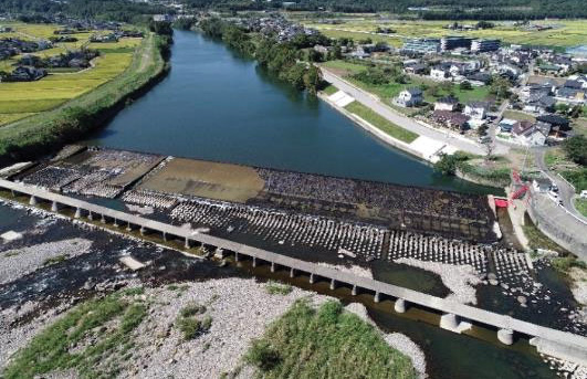
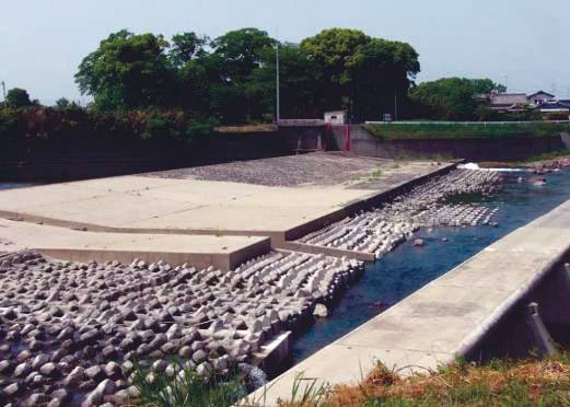
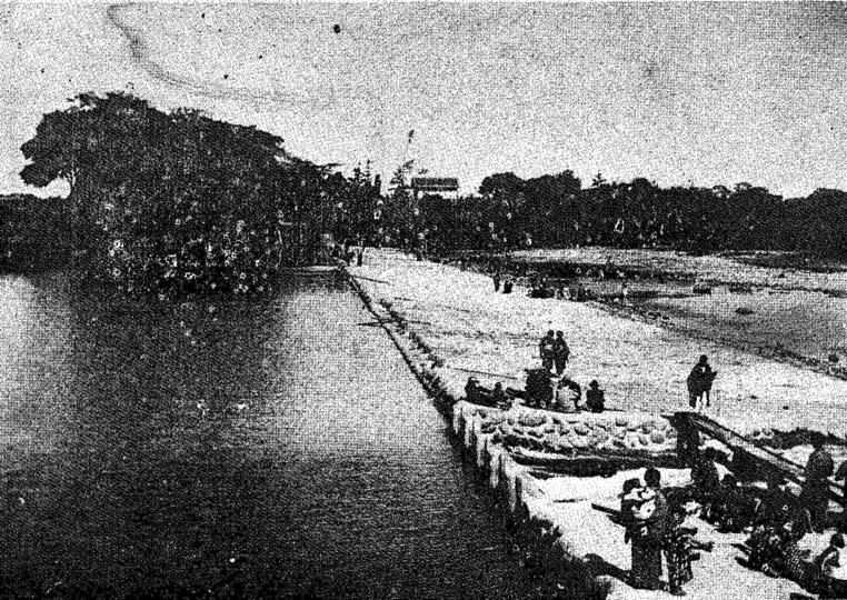
Hirata Irrigation System (constructed in 1156 AD): The Hirata Irrigation System was constructed in the low-lying area on the left side of the river. Its irrigated area has increased from the original approximate 140 ha to 1,546 ha at present whereas the main irrigation canal increased from 12 km to 25.6 km long. The irrigation system was smartly designed based on empirical knowledge of the river basin and represents the state of land development in ancient times. In particular, the 12th century is an important transitional period from ancient times to the Middle Ages. The irrigation system was smartly designed based on empirical knowledge of the river basin: the former riverbed was partially transformed into irrigation canals to distribute water efficiently to the low-lying paddy fields, and the weir and inlet (headwork) were constructed to intake water efficiently at the starting point of the alluvial fan. Water distribution was the most important issue in the irrigation system. The distribution was managed by the Hirata family, descendants of Usa Shrine, through the generations. In addition, small shrines have been constructed at the water division points to watch over the water division process. The irrigated area has gradually increased with the development of agricultural engineering.
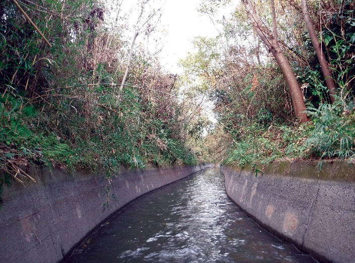
Hirose Irrigation System (constructed in 1870 AD): The Hirose Irrigation System was constructed to develop the slightly elevated plateau of the right side of the river. The irrigated area has increased from the original approximate 100 ha to 1,641 ha at present. The experience gained during this project enabled the engineers to build other important structures related to the modernization of Japan, including the Asaka, Nasu and Lake Biwa canals. The Hirose Irrigation System was constructed in 1870 to develop the slightly elevated plateau of the right side of the river. Construction of the irrigation system began in 1751. Owing to the application of advanced construction techniques, such as tunnels and aqueducts required to deliver water from the upper point of the river to the plateau, it took about 120 years to complete. As such, advanced construction techniques can be seen in this irrigation system: a 900-m irrigation canal was excavated through the mountainous area; stone arch bridges and inverted siphons were built across valleys; and a 17-km long main irrigation canal was constructed, with a precise slope of 1/1000. The irrigated area has increased from the original 100 ha to 1,641 ha at present. The main irrigation canal is 37.1 km long.
The slope of the river is steep and the river basin’s water-retaining capacity is insufficient to control the river flow because the soil layer in the upstream region is shallow. Therefore, droughts and floods occurred frequently in the river basin. The best agricultural technologies, such as an oblique weir in the headwork and irrigation canals along the geographical contours were used to construct the irrigation system. In an oblique weir, the angle of the weir is arranged to intake river water efficiently, and the height of the weir is set so as not to receive flood flow directly.
The Usa Irrigation System is still an important irrigation structure for rice production. It was designated a Globally Important Agricultural Heritage Site (GIAHS) in 2013 and is one of the important parts of the GIAHS, Kunisaki Peninsula Usa Integrated Forestry and Agriculture and Fisheries System.
HIGHLIGHTS
Country: Japan
Province: Oita Prefecture
Latitude : N33.51200 Longitude : E131.33680
Built: 1156–1870
River: Yakkangawa River
Basin: Yakkangawa River basin
Irrigated Area: 3,187 ha
72nd IEC Meeting, Marrakesh, Morocco, 2021