Menu
Menu
Dam and Old Sluices of Parakrama Samudraya
Profile; ?>Parakrama Samudraya is one of the largest and most famous reservoirs in Sri Lanka situated on the Mahaweli River (Amban Ganga) in Polonnaruwa District. The lake was constructed during the reign of King Parakramabahu (1153-1186 AD), who was one of the most powerful and famous rulers in Sri Lankan history. The lake was mainly constructed by connecting five mini lakes with a proper canal, now named Theppan Ala. The northernmost lake is called Thopa wewa, built by King Upathissa back in the 6th century, the middle one is Eramudu wewa, and the southernmost one is Dumbutulu wewa. There were two more lakes named Kalahagala wewa and Bhu wewa, but they were taken off from the main reservoir in the reconstruction process back in the 1950s.
There are a large number of stories that are related to the Parakrama Samudraya. One story tells that there was a small harbour-like part in the lake where small ships sailed through the Mahaweli River and Kalinga Ala (Canal) as King Parakramabahu is a ruler that conquered many foreign countries. The main feeder canal of the lake is named Angamadilla Yoda Ala, which was constructed by diverting the Amban Ganga. The ancient anicut called the “Raja Bamma” was reconstructed around 1939.
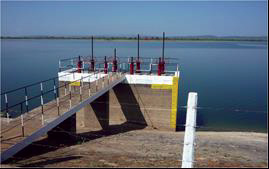
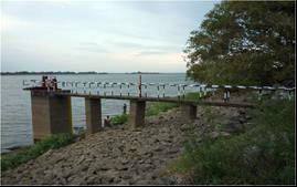
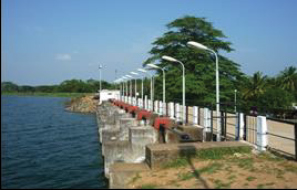
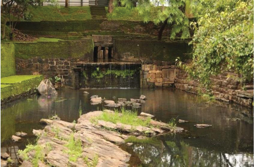
There are a few ancient sluice gates found around the lake and they are known to be some of the best ones in ancient history. The technology, the construction methods and the locations are unbelievable. One can be seen near the Lake Rest House which is located at the beginning of the Thopawewa dam. Another one is located in the Bendiwewa area and it is the one that anyone can investigate the technology well, as it is now separated from the old lake dam. And there is another one located nearly 15 km away from the Thopawewa. It is named “Bhuwewa Sorowwa” and the old Bhuwewa Lake has been filled up and encroached by farmers, as that part of the Parakrama Samudraya had been neglected when the rehabilitating process started back in the 1950s.
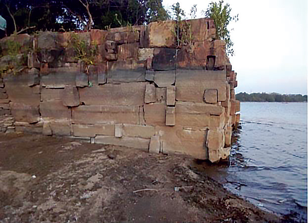
During 1937-1944, the lake was rehabilitated; the storage was increased from 98000 ac.ft to 110000 ac.ft, which was further increased up to 116100 ac.ft after the construction of modern spillway gates. The lake's catchment area is 72.52 km2. The dead storage is 15000 Acre ft, the full supply level of the lake is 59.43 m MSL and the High Flood Level is 59.74 m MSL. The dam is constructed as a homogenous earth-fill embankment. The length of the dam is 12.4 km and the average height is 15 m. The maximum height of the dam is 15.85 m. The lake is mainly fed by the water from Angamadilla Yoda Ala which is constructed by crossing the Amban Ganga at Angamadilla area.
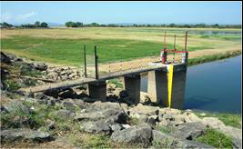
The stone pillars located in the dam were known to be the measurement posts at the time. They are named “Gaw Kanu” and one Gawwa is nearly similar to 1 km. There are ancient ruins of a castle in the middle of an island located in Parakarama Samudraya. It is known to be “Seetha Maligaya” and folk tales say that there were many castles in the middle of the ancient Parakrama Samudraya. And the ancient spillway was located in Bendiwewa and some remains of the ancient spillway canal can still be seen there. When the lake was founded in the late 1800s, there was just one breach which was about 60 ft in depth and 600 ft in width. It was then named Eramudu Kapolla and there was a canal named Diwulapitiya Ala, which carried a lot of water in rainy seasons.
Parakrama Samudra has irrigates more than 10100 ha and provided livelihood to a large number of inhabitants. Many people benefitted from various employments such as paddy cultivation, cultivation of other field crops, inland fish industry, ornamental fish production, home gardening, fertilizers production and animal husbandry. The Wasgamuwa National Park is considered a major feeding area of the lake. The tourism field is also highly benefited as the National Park is around the Parakrama Samudraya.
HIGHLIGHTS
Country: Sri Lanka
Province: Polonnaruwa District
Latitude : 7,941590 N Longitude : 80.998330 E
Built: 1153- 1186 AD
River: Mahaweli river, Amban ganga
Irrigated Area: More than 10100 Ha
72nd IEC Meeting, Marrakesh, Morocco, 2021