Menu
Menu
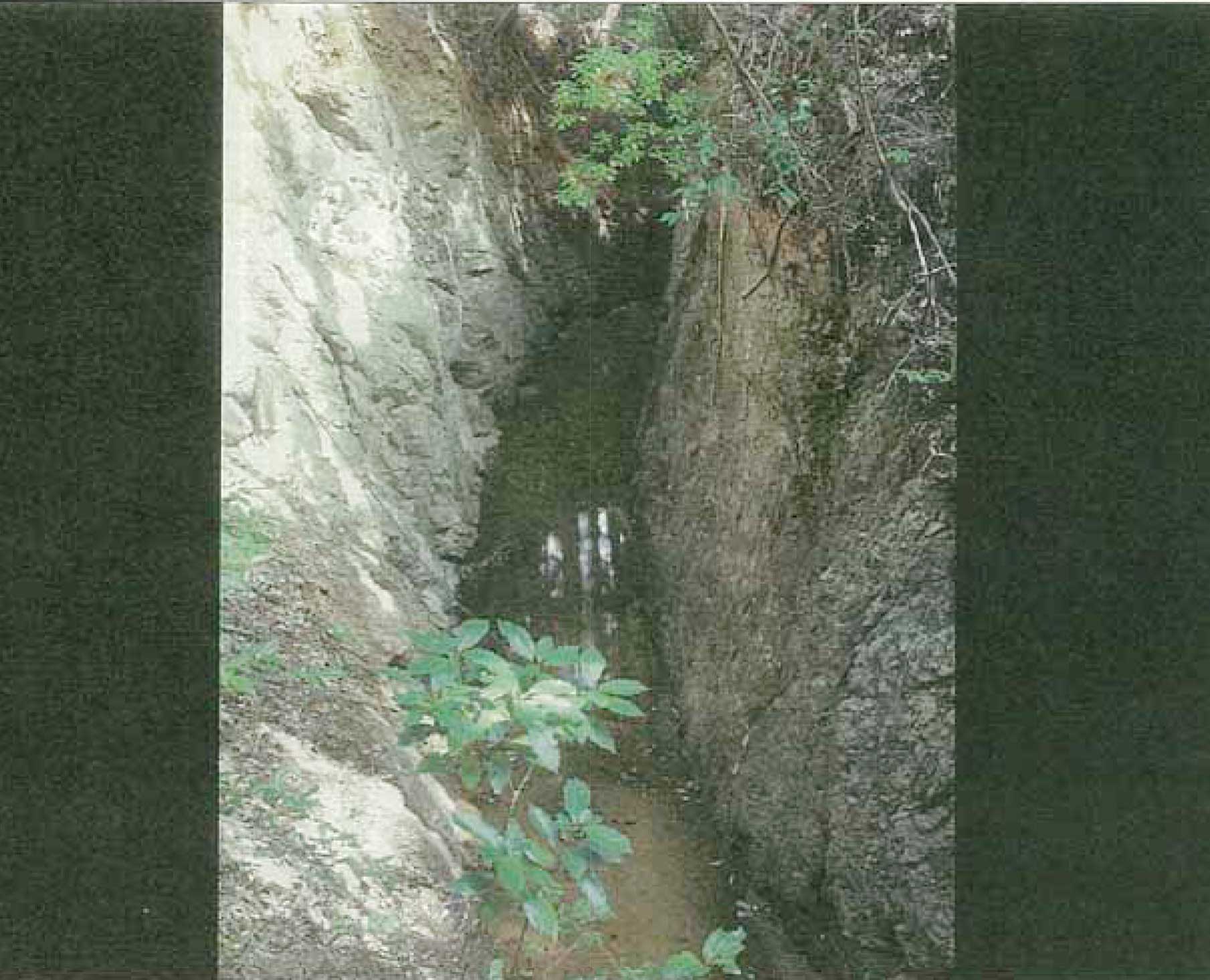
Tachibaiyousui Irrigation Canal
Profile; ?>Tachibaiyousui Irrigation Structure located in the Kushida River Basin in Japan is recognized for laying out a system of canals and cross drainage structures that required accurate surveying, and measuring of the elevation of land which was considered innovative for its time in terms of both planning and execution.
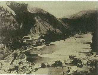
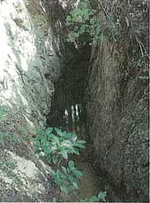
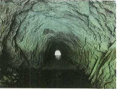
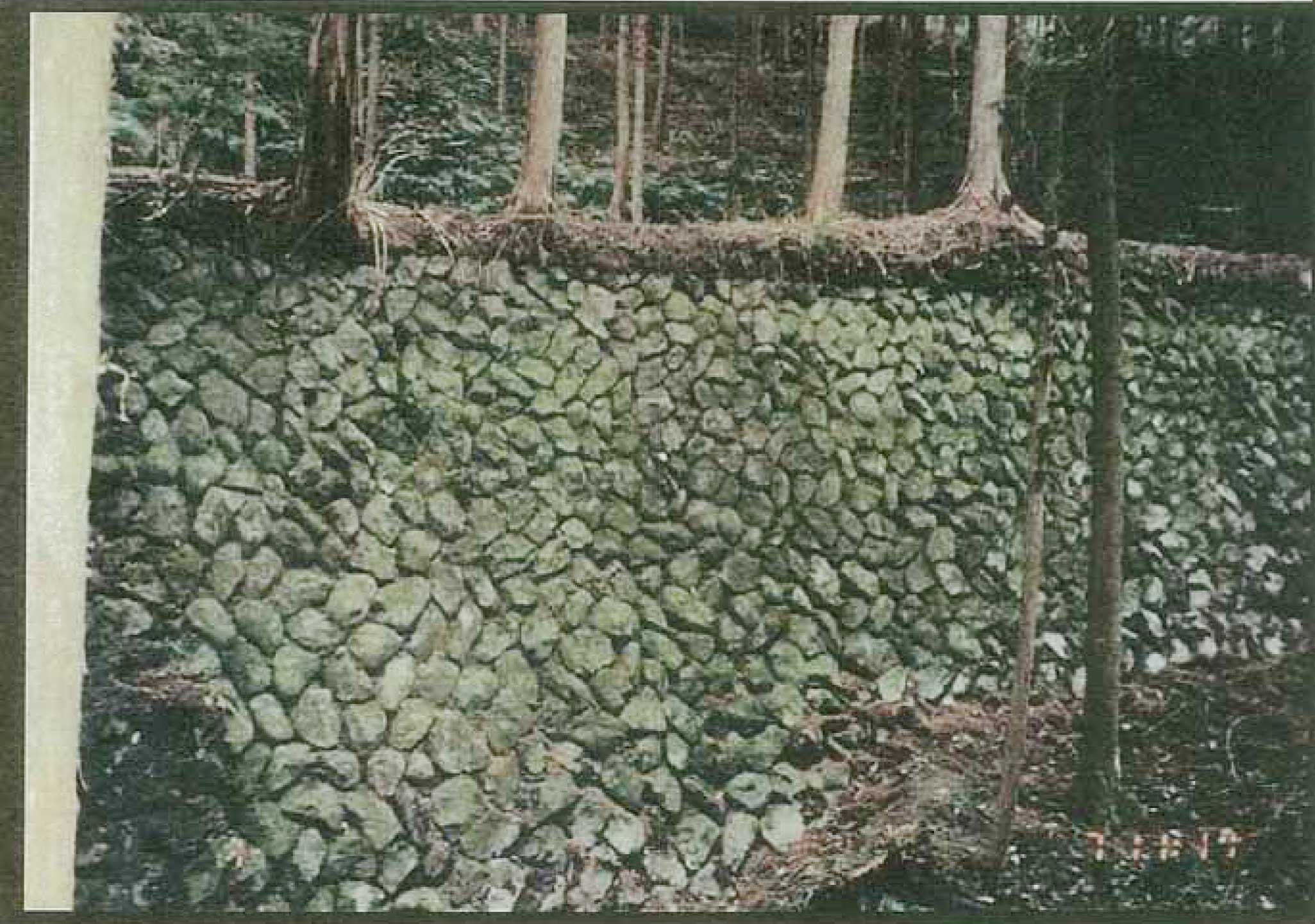
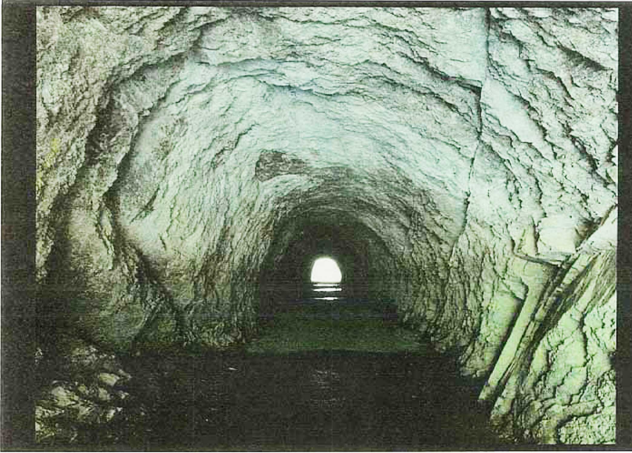
Tachibaiyousui Irrigation Canal was planned in 1808 and completed in 1823 to cater to the water needs of the area. The irrigation canal stretched to about 30 kilometers, cutting a winding path through the quickly thanks in part to digging technique that had been used for mercury mining in the area since the Nara Period (710-794). It went through several tunnels and mountain passes and over valley embankments, all of which was achieved through manual labor using only hammers and chisels. It was a grueling feat. The fact that the Kushida River bed was at lower elevation than the farmland to be irrigated and the volume of water in small brooks that flow out of the mountains was small and inconsistent meant that it was the local people could not create rice paddies and were forced to lead lives of scarcity.
Digging the irrigation canal through the foothills at high elevation enabled delivery of water to a wider area so that more rice paddies could be made. Also, the structure was designed so that water flowing down from the mountains after heavy rains was caught in the irrigation canal and discharged safely into the Kushida River, reducing the threat of water-related damage.
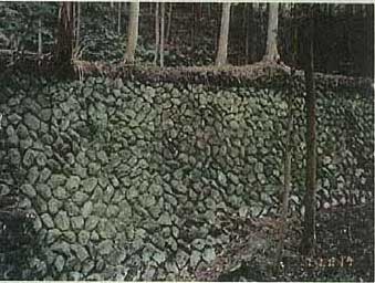
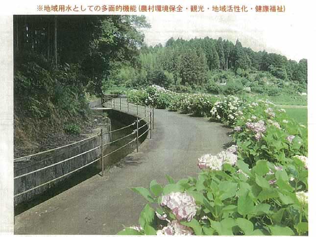
The canal follows a winding path that makes skillful use of the geographic features of the mountain foothills, and the great length of the canal made it possible to give it a water storage function as well, so as to supply water consistently to the irrigated region even during periods of little rainfall. When the irrigation structures were built, however, it enabled creation of approximately 160 hectares of rice paddies, and the people were lifted out of hardship thanks to a stable food supply. The five small villages in the area irrigated by the Tachibaiyousui Irrigation Canal all worked together to maintain the structures.
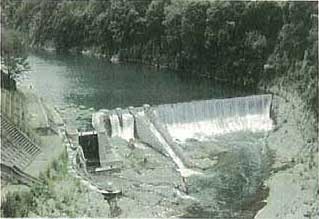
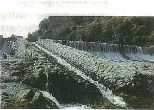
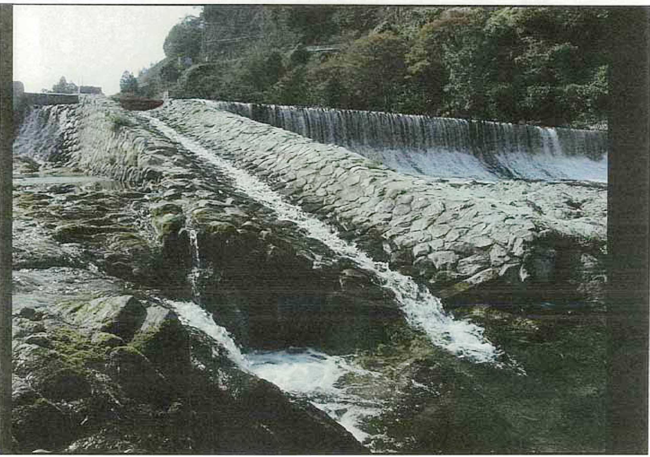
The Irrigation system now consists of one weir constructed on the Kushida River, 4.1 km of waterway for shared hydropower use, 21.8km of the main irrigation canal, 1.0 km of the Matsuyama tributary, 145 water diversion gates, 38 water discharge gates, and two storage ponds. The current Tachibai Weir is the fourth-generation weir constructed in April 1935, and is a stone dam structure. The structure is an extremely outstanding one in terms of both stonework and its picturesque appearance.
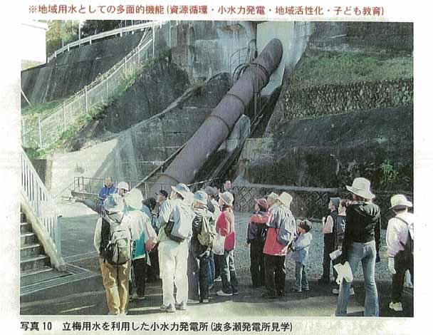
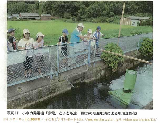
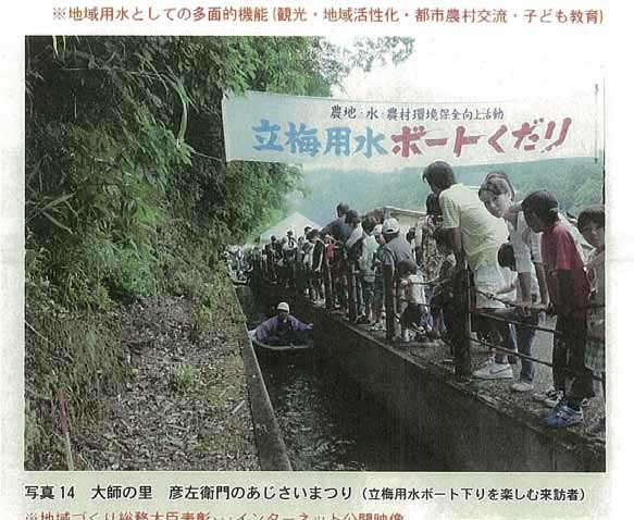
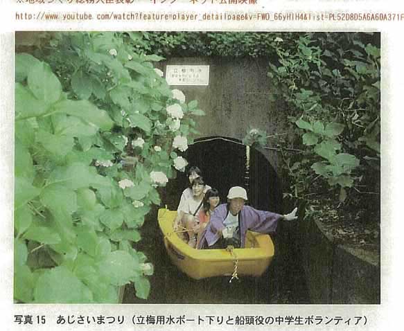
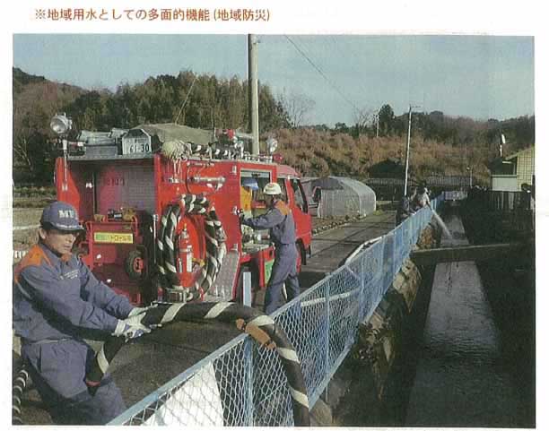
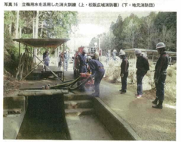
Tachibaiyousui Irrigation Canal is multi functional, used not only for irrigation but also for other purposes as well. The irrigation canal takes in water at the weir, part of which is diverted along the way to the Hatase Power Station. From there it flows down to the irrigated agricultural area lower in the basin at a maximum rate of 3.28 meters per second governed by customary water utilization rights, during the irrigation period from late April through late August. It also flows at a rate of 0.2 to 0.4 cubic meters per second during the non-irrigation period and is an indispensable part of life in the region.Its structures are the first agricultural water-related structures in Japan to apply for designation as Registered Monuments of Japanese by the Agency for Cultural Affairs.
HIGHLIGHTS
Country: Japan
Province:
Latitude : 34 o 27" Longitude : 136 o 27"
Built: Constructed in 1823 and reconstructed in 1935
River: Kushida River
Irrigated Area: 436 ha
65th IEC Meeting, Gwangju, Korea, 2014