Menu
Menu
Sodaiyousui Irrigation System
Profile; ?>As the rivers in the Sodai area were once shallow, and water could not be efficiently drawn from the main river, the local people suffered from annual droughts and low regional productivity. In spite of this, there were no large-scale irrigation systems in the area until the Sodaiyousui Irrigation System was constructed in 1669, and this was largely due to the administrative system at that time. The land in this region was divided up by several monarchs, and they were unable to work together to develop an irrigation system due to disagreements amongst themselves.
The local farmers of the area met together to discuss what to do about the situation, and came up with a plan for constructing the Sodai irrigation canal by themselves. This entrepreneurial process was rarely seen at the time in Japan, and is an indicator of the extent to which people in this area desperately needed an irrigation system. Needless to say, the farmers did also have conflicting interests among themselves, but they were nevertheless able to resolve these issues through the assignment of new rice paddies, as well as through other means.
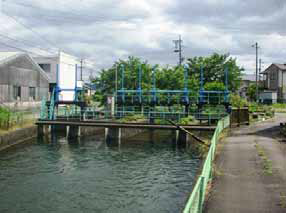
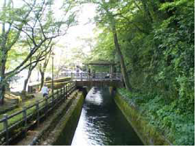
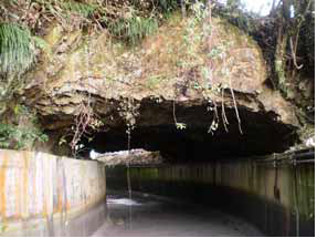
Construction was tough, with tagane and nomi (Japanese chisels) being used to dig into the bedrock, and the project was funded through generous investments made from the personal funds of local influential farmers. Ten years later, the 17km-long irrigation canal was completed, and the once barren area was transformed into beautiful new rice fields. It remains important facilities to this day, supporting a flourishing intensive agriculture industry. Nowadays, the local people have continued to work together to protect the canal system through community cleaning and weed-clearing projects, as well as by carrying out repairs. Further, the canals are studied by the local children in their environmental and educational lessons, and the history of the canals is explained in a supplementary textbook used by the local schools. In this way, work is being carried out to protect the irrigation system for future generations.
HIGHLIGHTS
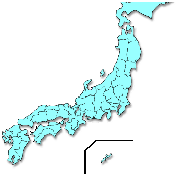
Country: Japan
Province:
Latitude : 35.34087o N Longitude : 136.55377o E
Built: 1669
River: Nagara-gawa
Sub-Basin: Kiso-gawa
Irrigated Area: 929 ha
66th IEC Meeting, Montpellier, France, 2015