Menu
Menu
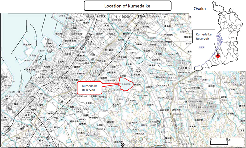
Kumedaike Reservoir
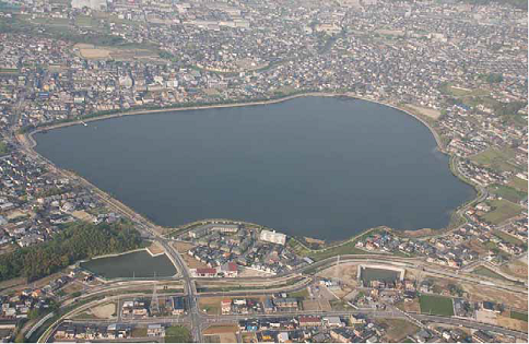
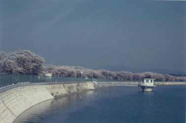
Profile; ?>Kumedaike Reservoir, with a 4.4 m embankment height, 2,650m perimeter, 45.6 ha reservoir area, and 1.57 million ton reservoir capacity, geographically straddles two neighborhoods, Ikejiri and Okayama, in Kishiwada City. It has the largest water area in Osaka Prefecture, and has the third largest capacity following Komyike and Sayamaike.
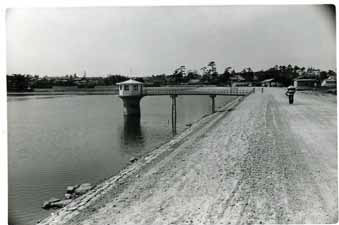
The construction of Kumedaike Reservoir dates back to the 8th century, and it was completed in 14 years, from 725 to 738. Since Kishiwada City, which is located in the south part of Osaka prefecture, has no large rivers and little rainfall, many ponds were constructed in ancient times. Rice cropping started around the 2nd century BC in the Kishiwada area, and likely earlier in the Yagi area, which is Kumedaike
HIGHLIGHTS
Country: Japan
Province:
Latitude : 34.45556o N Longitude : 135.41556o E
Built: 738 A.D.
River: Ohtsu-gawa
Basin: Ohtsu-gawa river basin
Irrigated Area: 27.7 ha
66th IEC Meeting, Montpellier, France, 2015